


Join Our Groups

NECTA 2012

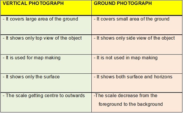
a) Name Three Types
of Geographical Photographs
- Ground or Horizontal
Photographs
- Oblique Photographs
- Vertical or Aerial Photographs
b) Specify the type
of Geographical Photograph which is:
i) Taken horizontally on the ground
Ground Photograph
ii)
Used in map making
Vertical Photograph
c) Explain five differences between the photograph you have mentioned in (b) (ii) above and topographical maps.
TOPOGRAPHICAL MAP
|
VERTICAL PHOTOGRAPH
|
- represents a vertical “plan” of a region
|
- It re
|
-
|
- Vertical photographs show small area
|
- It contains keys and scale
|
- It does not contain keys and scale
|
- It shows grid references
|
- It
|
- It
|
- It
|


EmoticonEmoticon